![](/images/other/stat-length.png)
![Excursión Senderismo Peyre en Aubrac - Chemin de St Guilhem - Variante N° 03 - Photo](https://media.geolcdn.com/t/1900/400/5bf276c2-8829-4a43-964f-b59caa08d971.jpg&format=pjpeg&maxdim=2)
Chemin de St Guilhem - Variante N° 03
Kargil
Usuario GUIDE
![Longitud](/images/other/stat-length.png)
![Altitud máxima](https://static1.geolcdn.com/siteimages/upload/files/1508320355ic_sort_altitude_max_24dp.png)
![Desnivel positivo](https://static1.geolcdn.com/siteimages/upload/files/1508320355ic_sort_den_pos_24dp.png)
![Km-Effort](/images/other/stat-length.png)
![Altitud mínima](https://static1.geolcdn.com/siteimages/upload/files/1508320355ic_sort_altitude_min_24dp.png)
![Desnivel negativo](https://static1.geolcdn.com/siteimages/upload/files/1508320355ic_sort_den_neg_24dp.png)
![Boucle](https://static1.geolcdn.com/siteimages/upload/files/16400158638029165_repeat_loop_refresh_sync_direction_icon.png)
![Senderismo](https://static1.geolcdn.com/sitytour/trail-icons/101.png)
72h48
Dificultad : Muy difícil
![Escanee este código QR para abrir la excursión en la aplicación SityTrail](https://capi.geolives.com/qq0zvz2zws4bq2lad0pu/sitytour/trails/2491610/qr.png?size=200)
Aplicación GPS de excursión GRATIS
A propósito
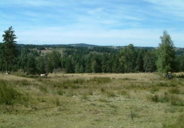
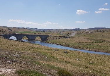
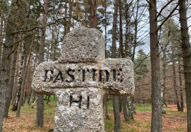
Ruta Senderismo de 247 km a descubrir en Occitania, Lozère, Peyre en Aubrac. Esta ruta ha sido propuesta por Kargil.
Descripción
C'est la variante la plus sportive qui passe par La Tieule et Saint Jean de Lévéjac.
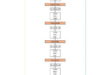
Tracée sur 14 jours
Le détail de chaque étape et 2 autres variantes sont publiées
Le synoptique joint en photo donne un aperçu des tracés
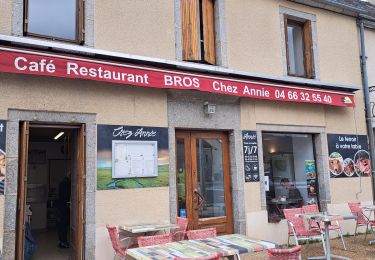
Enfin, il est temps de retourner à Aumont-Aubrac. La meilleure façon est d’utiliser les services de la Malle Postale (transports bagages et passagers) : www.lamallepostale.com.
Et pour rejoindre Montpellier TGV, ligne 668 de Hérault transports : www.herault-transport.fr
Puntos de interés
Localización
Comentarios
Excursiones cerca
![Excursión Senderismo Fontans - Les Estrets - Les 4 Chemins - Chemin de Compostelle - Photo](https://media.geolcdn.com/t/375/260/ext.jpg?maxdim=2&url=https%3A%2F%2Fservices.sitytrail.com%2FGeolivesWS%2FDownloadMedia.ashx%3FTrailID%3D108149%26Media%3D206_6.jpg)
![Senderismo Senderismo](https://static1.geolcdn.com/sitytour/trail-icons/101.png)
Senderismo
![](/images/other/stat-length.png)
![](https://static1.geolcdn.com/siteimages/upload/files/16400158638029165_repeat_loop_refresh_sync_direction_icon.png)
![Excursión Senderismo Peyre en Aubrac - Aumont Aubrac Nasbinal Avril 2018 - Photo](https://media.geolcdn.com/t/375/260/ext.jpg?maxdim=2&url=https%3A%2F%2Fservices.sitytrail.com%2FGeolivesWS%2FDownloadMedia.ashx%3FTrailID%3D954976%26Media%3Dfix__20180420140045.jpg)
![Senderismo Senderismo](https://static1.geolcdn.com/sitytour/trail-icons/101.png)
Senderismo
![](/images/other/stat-length.png)
![](https://static1.geolcdn.com/siteimages/upload/files/16400158638029165_repeat_loop_refresh_sync_direction_icon.png)
![Excursión Senderismo Peyre en Aubrac - Compostelle Aumont-Nasbinals - Photo](https://media.geolcdn.com/t/375/260/ext.jpg?maxdim=2&url=https%3A%2F%2Fstatic1.geolcdn.com%2Fsiteimages%2Fupload%2Ffiles%2F1553511878bg_sport_marche.png)
![Senderismo Senderismo](https://static1.geolcdn.com/sitytour/trail-icons/101.png)
Senderismo
![](/images/other/stat-length.png)
![](https://static1.geolcdn.com/siteimages/upload/files/16400158638029165_repeat_loop_refresh_sync_direction_icon.png)
![Excursión Senderismo Peyre en Aubrac - Lasbros - Photo](https://media.geolcdn.com/t/375/260/c0f2421e-e54c-492c-b4c7-7d17496731f8.jpg&format=jpg&maxdim=2)
![Senderismo Senderismo](https://static1.geolcdn.com/sitytour/trail-icons/101.png)
Senderismo
![](/images/other/stat-length.png)
![](https://static1.geolcdn.com/siteimages/upload/files/16400158638029165_repeat_loop_refresh_sync_direction_icon.png)
![Excursión Senderismo Peyre en Aubrac - Étape 1 Saint Gilhem - Photo](https://media.geolcdn.com/t/375/260/2d822680-c426-4c5d-a29b-3495a4f31f4e.jpg&format=jpg&maxdim=2)
![Senderismo Senderismo](https://static1.geolcdn.com/sitytour/trail-icons/101.png)
Senderismo
![](/images/other/stat-length.png)
![](https://static1.geolcdn.com/siteimages/upload/files/16400158638029165_repeat_loop_refresh_sync_direction_icon.png)
![Excursión Senderismo Peyre en Aubrac - Mon chemin de St Guilhem étape 1 - Photo](https://media.geolcdn.com/t/375/260/6d064fd1-514a-4cb7-a19e-2096a1e7542e.jpg&format=jpg&maxdim=2)
![Senderismo Senderismo](https://static1.geolcdn.com/sitytour/trail-icons/101.png)
Senderismo
![](/images/other/stat-length.png)
![](https://static1.geolcdn.com/siteimages/upload/files/16400158638029165_repeat_loop_refresh_sync_direction_icon.png)
![Excursión Senderismo Peyre en Aubrac - le rocher du Cher - Photo](https://media.geolcdn.com/t/375/260/521b0f14-15fb-43d0-a0a1-e5e04c239576.jpg&format=jpg&maxdim=2)
![Senderismo Senderismo](https://static1.geolcdn.com/sitytour/trail-icons/101.png)
Senderismo
![](/images/other/stat-length.png)
![](https://static1.geolcdn.com/siteimages/upload/files/16400158638029165_repeat_loop_refresh_sync_direction_icon.png)
![Excursión Coche Peyre en Aubrac - javols - Photo](https://media.geolcdn.com/t/375/260/88751dea-9888-4bf8-b1cf-5a47c42c86ef.jpg&format=jpg&maxdim=2)
![Coche Coche](https://static1.geolcdn.com/sitytour/trail-icons/401.png)
Coche
![](/images/other/stat-length.png)
![](https://static1.geolcdn.com/siteimages/upload/files/16400158638029165_repeat_loop_refresh_sync_direction_icon.png)
![Excursión Senderismo Peyre en Aubrac - Chemin de St Guilhem - Variante N° 02 - Photo](https://media.geolcdn.com/t/375/260/eb608073-7364-4397-a13a-89fe8167e70f.jpg&format=jpg&maxdim=2)
![Senderismo Senderismo](https://static1.geolcdn.com/sitytour/trail-icons/101.png)
Senderismo
![](/images/other/stat-length.png)
![](https://static1.geolcdn.com/siteimages/upload/files/16400158638029165_repeat_loop_refresh_sync_direction_icon.png)